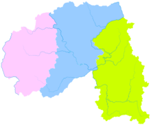
Xishuangbanna Dai Autonomous Prefecture
Autonomous prefecture in Yunnan Province, ChinaXishuangbanna, sometimes shortened to Banna, is one of the eight autonomous prefectures of Yunnan Province. The autonomous prefecture for Dai people is in the extreme south of Yunnan province, China, bordering both Myanmar and Laos. Xishuangbanna lies at latitude 21°10′-22°40′ and longitude 99°55′-101°50′ east, on the northern edge of the tropics south of the Tropic of Cancer. It has an area of 19,124.5 square kilometers, bordering Pu'er City to the northeast and northwest, Laos to the southeast and Myanmar to the southwest. The border is 966.3 kilometers long, one river connects six countries, and there are four national ports. The prefectural seat is Jinghong, the largest settlement in the area and one that straddles the Mekong, called the "Lancang River" in Chinese.


