Woldingham
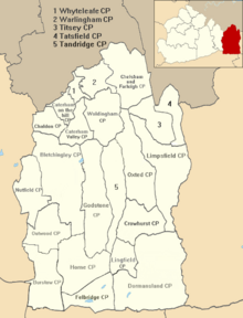
Village and parish in Surrey, EnglandWoldingham is a village and civil parish high on the North Downs between Oxted and Warlingham in Surrey, England, within the M25, 17.5 miles (28.2 km) southeast of London. The village has 2,141 inhabitants, many of whom commute to London, making Woldingham part of the London commuter belt. The village is served by the Oxted line and central London can be reached in 33 minutes by train.
Read article
Top Questions
AI generatedMore questions
Nearby Places

Woldingham railway station
Railway station in Surrey, England

Caterham and Warlingham Urban District
Urban District of Surrey, England

Woldingham School
Independent school in Woldingham, Surrey, England

Titsey Woods

Woldingham and Oxted Downs
Forest east of Caterham, Surrey, England

Blanchman's Farm
Nature reserve in Surrey, United Kingdom

Hill Park, Tatsfield

Nore Hill Pinnacle
Local nature reserve in Surrey, England


