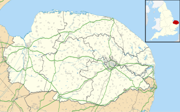
Wendling, Norfolk
Human settlement in EnglandWendling is a village and civil parish in the English county of Norfolk. It covers an area of 5.25 km2 (2.03 sq mi) and had a population of 323 in 140 households at the 2001 census, reducing to a population of 313 in 129 households at the 2011 Census. For the purposes of local government, it falls within the district of Breckland.
Read article
Top Questions
AI generatedMore questions
Nearby Places
![Thumbnail](https://upload.wikimedia.org/wikipedia/commons/thumb/0/05/Site_of_Wendling_railway_station%2C_Norfolk.jpg/180px-Site_of_Wendling_railway_station%2C_Norfolk.jpg)
Wendling railway station
Former railway station in England
Fransham
Civil parish in Norfolk, England
![Thumbnail](https://upload.wikimedia.org/wikipedia/commons/thumb/1/12/St_Peter_and_St_Paul_Church%2C_Scarning_-_geograph.org.uk_-_357024.jpg/180px-St_Peter_and_St_Paul_Church%2C_Scarning_-_geograph.org.uk_-_357024.jpg)
Scarning
Village in Norfolk, England
Scarning railway station
Former railway station in England
Wendling Abbey
![Thumbnail](https://upload.wikimedia.org/wikipedia/commons/thumb/2/28/Looking_south_alongside_Honeypot_Wood_-_geograph.org.uk_-_607155.jpg/180px-Looking_south_alongside_Honeypot_Wood_-_geograph.org.uk_-_607155.jpg)
Honeypot Wood
Site of Special Scientific Interest in Norfolk, England
![Thumbnail](https://upload.wikimedia.org/wikipedia/commons/thumb/d/da/Mitford_and_Launditch_RD_1935.png/180px-Mitford_and_Launditch_RD_1935.png)
Mitford and Launditch Rural District
Former local government area in the UK
![Thumbnail](https://upload.wikimedia.org/wikipedia/commons/thumb/5/5b/Holly_Farm_Meadow%2C_Wendling.jpg/180px-Holly_Farm_Meadow%2C_Wendling.jpg)
Holly Farm Meadow, Wendling
Protected area in Norfolk, England