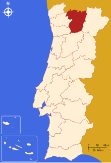
Vila Real District
District of PortugalThe District of Vila Real is a district of northern Portugal. With an area of 4,239 km2 (1,637 sq mi), the district is located east of the port city of Porto and north of the Douro River. Vila Real has always belonged to the historical province of Trás-os-Montes. Approximate population in the 2001 census was 230,000. The population has shown negative rates in recent years due to emigration and aging. Many of the villages have lost population and have become deserted while the district capital has gained in population. It is bordered by Spain (Galicia) in the north and east, Braga District and Porto District in the west, Viseu District in the south and Bragança District in the east.
Read article
Top Questions
AI generatedMore questions
Nearby Places

University of Trás-os-Montes and Alto Douro
Public university in Vila Real, Portugal

Trás-os-Montes e Alto Douro Province

Douro (intermunicipal community)
Intermunicipal community in Norte, Portugal

Mateus Palace
House in Vila Real, Portugal

Vila Real
Municipality in Norte, Portugal

Cathedral of Vila Real

Vila Real Bridge
Bridge in Vila Real District
Botanical Garden of the University of Trás-os-Montes e Alto Douro
Botanic garden in Portugal


