Vallée des Rouets
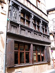
The Vallée des Rouets is a part of the valley of the river Durolle, principally situated on the land of Thiers, in the French department of Puy-de-Dôme in the Auvergne-Rhône-Alpes region. The area is known for its long artisanal past, as the inhabitants have made use of the locomotive power of the Durolle River since the Middle Ages. The beginning of the 20th century marked the closure of most of the water-powered mills in the valley in favor of the production of cutlery, mainly situated in the Vallée des Usines, located downstream.
Read article


Top Questions
AI generatedMore questions
Nearby Places

Thiers, Puy-de-Dôme
Subprefecture and commune in Auvergne-Rhône-Alpes, France
La Monnerie-le-Montel
Commune in Auvergne-Rhône-Alpes, France
Cutlery Museum
CMuseum, historic site in Thiers, France
Canton of Thiers

Église Saint-Genès de Thiers

Creux de l'Enfer
French art gallery

Thiers old hospital
Thiers former hospital from the 17th century.

Vallée des Usines
Complex of former industrial buildings on Thiers.