Valenton
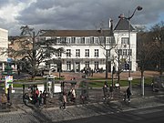
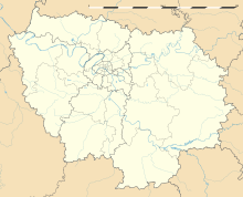
Commune in Île-de-France, FranceValenton is a commune in the southeastern suburbs of Paris, France. It is located 15.1 km (9.4 mi) from the center of Paris. It extends over 531 hectares of which 84 hectares are green spaces. The most important public green space is the Plage Bleue Park where different events are organized every year. Among them, we have the Festival de l’Oh focused on environmental issues dealing with aquatic resources. Valenton is surrounded by the towns of Choisy-le-Roi, Créteil, Crosne, Limeil-Brévannes, Villeneuve-Saint-Georges and Yerres. The town can be reached through the motorway A86 and the main road RN6. It is connected to the suburban rail network with the RER line D or RER line A at Boissy-Saint-Léger.
Read article
Top Questions
AI generatedMore questions
Nearby Places

Villeneuve-Saint-Georges
Commune in Île-de-France, France

Limeil-Brévannes
Commune in Île-de-France, France

Stade Dominique Duvauchelle
Multi-use stadium in Créteil, France

Château de Choisy
Demolished French royal residence

Pointe du Lac station
Metro station in Paris, France

Villeneuve-Triage station
Canton of Villeneuve-Saint-Georges

Villeneuve-Saint-Georges station
Railway station in Villeneuve-Saint-Georges, France


