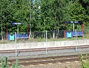
Uplands, Norway
The Uplands, is an ancient name for the agricultural lands and forest regions to the north of Oslo in Norway. The term generally included the districts Romerike, Ringerike, Hedmarken, Toten, Hadeland and Land. To the north, these lands branched out through valleys to the districts Gudbrandsdalen, and Østerdalen, which often were counted as part of the Uplands as well. It has also been implied that the districts Hallingdal, Numedal, Valdres, and Telemark were also included.
Read article
Top Questions
AI generatedMore questions
Nearby Places

Briskeby Stadion
Stadium in Hamar Municipality, Norway

Eidsivating Court of Appeal
Norwegian Court of Appeals

Hedmarken District Court
District court in Innlandet, Norway

Hamar stadion
Bandy stadium in Hamar, Norway

Vikingskipet Station
Briskebyen, Hedmark
Neighborhood of Hamar, Norway

Hedmark County Municipality
Former County in Norway

Østre Innlandet District Court
First-instance law court in Norway
