Tokelau
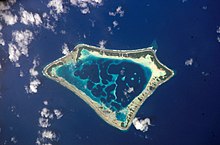
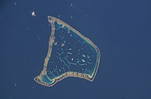
Dependent territory of New Zealand in the southern Pacific OceanTokelau is a dependent territory of New Zealand in the southern Pacific Ocean. It consists of three tropical coral atolls: Atafu, Nukunonu, and Fakaofo. They have a combined land area of 10 km2 (4 sq mi). In addition to these three, Swains Island, which forms part of the same archipelago, is the subject of an ongoing territorial dispute; it is currently administered by the United States as part of American Samoa. Tokelau lies north of the Samoan Islands, east of Tuvalu, south of the Phoenix Islands, southwest of the more distant Line Islands, and northwest of the Cook Islands.
Read article
Top Questions
AI generatedMore questions
Timeline
AI Generated- 1765-06-24The first European to sight Atafu, British Navy officer Commodore John Byron.
- 1791-06-06Captain Edward Edwards visits Atafu in search of the Bounty mutineers.
- 1791-06-12Edwards sails farther south and sights Nukunonu, naming it "Duke of Clarence's Island".
