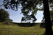
The Ridgeway
Ancient trackway described as Britain's oldest roadThe Ridgeway is a ridgeway or ancient trackway described as Britain's oldest road. The section clearly identified as an ancient trackway extends from Wiltshire along the chalk ridge of the Berkshire Downs to the River Thames at the Goring Gap, part of the Icknield Way which ran, not always on the ridge, from Salisbury Plain to East Anglia. The route was adapted and extended as a National Trail, created in 1972. The Ridgeway National Trail follows the ancient Ridgeway from Overton Hill, near Avebury, to Streatley, then follows footpaths and parts of the ancient Icknield Way through the Chiltern Hills to Ivinghoe Beacon in Buckinghamshire. The National Trail is 87 miles (140 km) long.
Read article


Top Questions
AI generatedMore questions
Nearby Places
DIDO (nuclear reactor)
Materials testing nuclear reactor housed at Harwell, Oxfordshire, United Kingdom
PLUTO reactor
Materials testing nuclear reactor at Harwell, Oxfordshire, United Kingdom
KARMEN

ISIS Neutron and Muon Source
English physics research facility
ENGIN-X
Scutchamer Knob
West Ginge
Human settlement in England
Central Laser Facility