The Kilmog
Hilly area near Dunedin, New ZealandThe Kilmog, occasionally called Kilmog Hill and known in Māori as Kirimoko, is a hilly area approximately 20 kilometres north of Dunedin, New Zealand, on State Highway 1, to the north of Blueskin Bay and south of Karitane. Technically more a series of hills than a single hill, it lies between the south branch of the Waikouaiti River and the Pacific Ocean, and reaches its highest point at the 431 m (1436 ft) Hammond Hill, close to the farming community of Merton. A second peak, Porteous Hill, lies at the southern end of the Kilmog, rising to 395 m (1317 ft).
Read article
Top Questions
AI generatedMore questions
Nearby Places

Warrington, New Zealand
Town in South Island, New Zealand

Blueskin Bay
Seacliff, New Zealand
Village in Otago, New Zealand
Evansdale, New Zealand
Locality in Otago, New Zealand
Careys Creek
River in New Zealand
St Barnabas Church, Warrington
Church in New Zealand
Evansdale statistical district
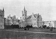
Seacliff Lunatic Asylum
Hospital in Seacliff, New Zealand