Tana River County
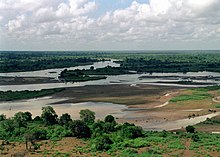
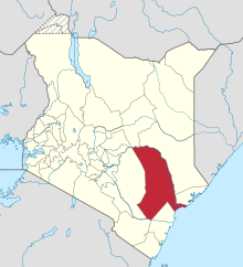
County in KenyaTana River County is a county in the former Coast Province of Kenya. It is named after the Tana River, the longest river in Kenya. It has an area of 38,437 km2 (14,841 sq mi) and had a population of 315,943 as of the 2019 census. The county borders Kitui County to the west, Garissa County to the northeast, Isiolo County to the north, Lamu County to the southeast, Kilifi County to the south and the Indian ocean The administrative headquarters of the county is Hola also known as Galole. The County has five (5) sub Counties; Tana Delta, Tana River, Tana North, Galedyertu, and Bangal.
Read article
Top Questions
AI generatedMore questions


