Sword Beach
Allied D-Day landing zone, 6 June 1944Sword, commonly known as Sword Beach, was the code name given to one of the five main landing areas along the Normandy coast during the initial assault phase, Operation Neptune, of Operation Overlord. The Allied invasion of German-occupied France commenced on 6 June 1944. Stretching 8 kilometres (5.0 mi) from Ouistreham to Saint-Aubin-sur-Mer, the beach proved to be the easternmost landing site of the invasion after the abortion of an attack on a sixth beach, code-named Band. Taking Sword was to be the responsibility of the British Army with sea transport, mine sweeping and a naval bombardment force provided by the British Royal Navy as well as elements from the Polish, Norwegian and other Allied navies.
Read article


Top Questions
AI generatedMore questions
Nearby Places

Operation Epsom
Allied military operation in France in 1944
Hermanville-sur-Mer
Commune in Normandy, France

Lion-sur-Mer
Commune in Normandy, France

Luc-sur-Mer
Commune in Normandy, France

Luc-sur-Mer station
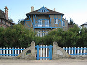
La Bluette
Normandy villa
Villa Louis, Lion-sur-Mer
House in France

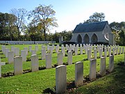
Hermanville War Cemetery
Military cemetery in France