Map Graph

Sunderland

City in Tyne and Wear, England

Sunderland is a port city in Tyne and Wear, England. It is a port at the mouth of the River Wear on the North Sea, approximately 10 miles (16 km) south-east of Newcastle upon Tyne. The built-up area had a population of 168,277 at the 2021 census, making it the second largest settlement in North East England after Newcastle. It is the administrative centre of the metropolitan borough of the same name.

Read article
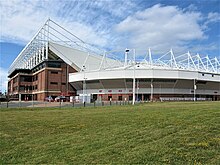
File:SunderlandBridges.jpgFile:Sunderland_stadium_of_light.jpgFile:St._Peter's_Campus.jpgFile:Sunderland_Museum_and_Winter_Gardens_from_Mowbray_Park,_7th_May_2002._-_geograph.org.uk_-_136929.jpgFile:Roker_North_pier_lighthouse._-_geograph.org.uk_-_496521.jpgFile:Tyne_and_Wear_UK_location_map.svgFile:Northumbria.rise.600.700.jpgFile:St_peters_sunderland.jpgFile:10_Church_Street_(13920301659).jpgFile:HolyTrinitySunderland-apse.jpgFile:A_South_East_View_of_the_Cast_Iron_Bridge_over_the_River_Wear_at_Sunderland.jpgFile:Plan_of_Sunderland,_Bishopwearmouth_and_Monkwearmouth,_1817.jpgFile:Commemorative_plates_Sunderland_Museum_and_Winter_Gardens_(8096466202).jpgFile:The_Ropery,_Sunderland_(geograph_3880645).jpgFile:Sunderland_Docks_Office_(13920362930).jpgFile:William_Pile's_Shipyard,_North_Sands,_Sunderland.jpgFile:An_Aerial_view_of_Sunderland_(9105585273).jpgFile:1937wembleylapofhonour.jpgFile:Deptford,_Sunderland_14.9.1917.jpgFile:Women_working_in_the_shipyard_(10817948524).jpgFile:Wearmouth_Bridge_to_the_Sea_2nd_March_1967.jpgFile:NMUK.JPGFile:Durham_-_John_Speed_Map.jpgFile:Borough_of_Sunderland_COA.pngFile:Official_portrait_of_Bridget_Phillipson_MP_crop_2.jpgFile:Julieface.jpgFile:Official_portrait_of_Mrs_Sharon_Hodgson_MP_crop_2.jpgFile:Sunderland_panoramic_riverside.jpgFile:Wearmouth_Bridge,_Sunderland.jpgFile:Former_Post_Office,_Sunderland_-_geograph.org.uk_-_6167258.jpgFile:Keel_Square.jpgFile:Shipbuilding_during_the_First_World_War_Q20119.jpgFile:Radiant_II_is_launched_into_the_River_Wear_(14508024713).jpgFile:Sunderland_Liebherr_Riverside.jpgFile:University_of_Sunderland_Sports_Buildings,_Chester_Road_-_geograph.org.uk_-_2079145.jpgFile:Sunderland_station_Metro_platforms.jpgFile:Sunderland_Metro_Map.pngFile:Pallion_station_02.jpgFile:Riverside_path_and_Northern_Spire,_Sunderland_(geograph_5963579).jpgFile:Main_roads_in_sunderland.jpgFile:Buses_in_Park_Lane_Interchange_-_geograph.org.uk_-_1748466.jpgFile:Red_Arrows_Sunderland_Airshow_2009_(2).jpgFile:Sunderland_harbour.jpgFile:Sunderland_Marina_-_geograph.org.uk_-_4068800.jpgFile:Glass_Museum_Sunderland_-_geograph.org.uk_-_501440.jpgFile:Hylton_Castle_In_The_Summer.jpgFile:Museum_and_Winter_Gardens_-_Mowbray_Gardens_-_geograph.org.uk_-_514186.jpgFile:Sunderlandstreets2.jpgFile:Sunderland_Empire.jpgFile:Stadium_of_Light,_Sunderland_-_geograph.org.uk_-_5813943.jpgFile:Sunderland_Aquatic_Centre_-_geograph.org.uk_-_1665091.jpg
Top Questions
AI generated

List the top facts about Sunderland

Summarize this article

What is the single most intriguing fact about Sunderland?

Are there any controversies surrounding Sunderland?

More questions