Sudbury Basin
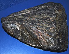
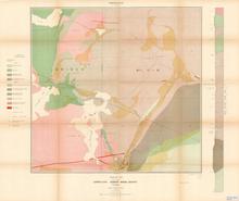
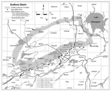
Third largest verified astrobleme on earth, remains of an Paleoproterozoic Era impactThe Sudbury Basin, also known as Sudbury Structure or the Sudbury Nickel Irruptive, is a major geological structure in Ontario, Canada. It is the third-largest known impact structure on Earth, as well as one of the oldest. The structure, the eroded remnant of an impact crater, was formed by the impact of an asteroid 1.849 billion years ago in the Paleoproterozoic era.
Read article
Top Questions
AI generatedMore questions
Timeline
AI Generated- 1856Provincial land surveyor Albert Salter located magnetic abnormalities suggestive of mineral deposits while surveying a baseline westward from Lake Nipissing.
- 1883Development of a mining settlement occurred after blasting at the railway construction site revealed a large concentration of nickel and copper ore at what is now the Murray Mine site.
- 1889Frank Sperry made the first identification of the arsenide of platinum at the Vermillion Mine.
Nearby Places

Greater Sudbury
City in Ontario, Canada

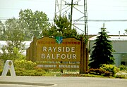
Rayside-Balfour
Community in Ontario, Canada

Sudbury Downs
Harness racing track in Greater Sudbury, Canada

Sudbury/Azilda Water Aerodrome
Airport in Greater Sudbury, Ontario
Chelmsford Valley District Composite School
School in Chelmsford, Ontario, Canada
École Secondaire Catholique Champlain
Chelmsford station (Ontario)
Railway station in Greater Sudbury, Canada

Onaping River
River in Ontario, Canada


