Stillaguamish River
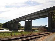
River in Washington, United StatesThe Stillaguamish River is a river in the northwestern region of the U.S. state of Washington. It is mainly composed of two forks, the longer North Fork Stillaguamish and the South Fork Stillaguamish. The two forks join near Arlington. From there the Stillaguamish River proper flows for 22 miles (35 km) to Puget Sound. The river's watershed drains part of the Cascade Range north of Seattle.
Read article


Top Questions
AI generatedMore questions
Nearby Places

Northwest Stanwood, Washington
CDP in Washington, United States

Stanwood, Washington
City in Washington, United States
Mark Clark Bridge
Bridge in Stanwood, Washington
Stanwood High School
Public school in the United States

Stanwood station
Train station in Stanwood, Washington

Floyd Norgaard Cultural Center
United States historic place
Leque Island
Florence Island (Washington)