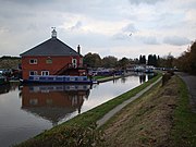
Statfold
Former village in Staffordshire, EnglandStatfold is a former village and civil parish, now in the parish of Thorpe Constantine, in the Lichfield district, in Staffordshire, England. It is about 3 miles (5 km) north-east of Tamworth. These days little remains of the village itself, but the Norman parish church, and the Tudor manor house of Statfold Hall still exist, as do a few scattered farms and houses. In 1931 the parish had a population of 55.
Read article
Top Questions
AI generatedMore questions
Nearby Places

Statfold Barn Railway
Railway in England

Alvecote
Human settlement in England

Shuttington
Human settlement in England

Amington Hall
Building in Amington, England

Thorpe Constantine
Village in Staffordshire, England

Alvecote Pools

Seckington
Human settlement in England

St Editha's Church, Amington
Church in Staffordshire, England

