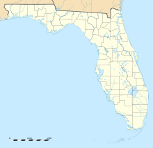
Map Graph
No coordinates found

Florida State Road A1A

State highway in Florida, United States

State Road A1A (SR A1A) is a major north–south Florida State Road consisting of seven separate sections running a total of 338.752 miles (545.168 km) along the Atlantic Ocean, from Key West at the southern tip of Florida, to Fernandina Beach, just south of Georgia on Amelia Island, before turning inland to Callahan. It is the main road through most oceanfront towns. Part of SR A1A is designated the A1A Scenic and Historic Coastal Byway, a National Scenic Byway. SR A1A is famous worldwide as a center of beach culture in the United States, a scenic coastal route through most Atlantic coastal cities and beach towns, including the unique tropical coral islands of the Florida Keys. SR A1A also serves as a major thoroughfare through Miami Beach and other south Florida coastal cities.

Read article
File:Florida_A1A.svgFile:Flaglerbeach.jpgFile:Beginning_of_A1A.JPGFile:FL_A1A_NB_past_FL_732.jpegFile:FL_A1A_NB_approaching_Seaway_Drive.jpegFile:FL_A1A_NB_past_US_92.jpgFile:A1AnRoadEnd-US1nsUS23nsUS301ns-CallahanFL_(32302420820).jpgFile:FL-A1A_17th_st_causeway.jpgFile:New_Smyrna_A1A_south_causeway01.jpgFile:Port_Orange_A1A_bridge01.jpgFile:DaytonaBeach-A1A-South.jpgFile:Florida_1.svgFile:Key_West_FL_A1A-01.jpgFile:FL_A1A_in_Boca_Raton,_FL.JPGFile:Florida_A1A_sign_in_St._Augustine.jpgFile:Orchid_FL_Jungle_Trail02.jpgFile:USA_Florida_location_map.svgFile:Usa_edcp_location_map.svgFile:CanaveralNationalSeashore0.jpg
Top Questions
AI generated

List the top facts about Florida State Road A1A

Summarize this article

What is the single most intriguing fact about Florida State Road A1A?

Are there any controversies surrounding Florida State Road A1A?

More questions