Southmead
Human settlement in EnglandSouthmead is a northern suburb and council ward of Bristol, in the south west of England, bordered by Filton in South Gloucestershire and Monks Park, Horfield, Henleaze and Westbury on Trym.
Read article


.jpg)

.jpg)

Top Questions
AI generatedMore questions
Nearby Places
Brentry
Human settlement in England

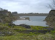
Pen Park Hole
Bristol North (UK Parliament constituency)
Parliamentary constituency in the United Kingdom, 1885–1950
Magnesian Conglomerate
Bristol Free School
Free school in Bristol, England
North Bristol NHS Trust

Brentry Hospital
Former hospital in England
Avon Fissure Fill