South Holland District
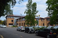
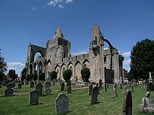
Non-metropolitan district in EnglandSouth Holland is a local government district of Lincolnshire, England. The council is based in Spalding. Other notable towns and villages include Crowland, Sutton Bridge, Donington, Holbeach and Long Sutton. The district is named after the historical division of Lincolnshire known as the Parts of Holland.
Read article
Top Questions
AI generatedMore questions
Nearby Places
Spalding Rural District

Cowbit
Village and civil parish in Lincolnshire, England

Cowbit railway station
Former railway station in Lincolnshire, England
Gordon Boswell Romany Museum
Museum of Romany artifacts

New River (Fens)
Drainage channel in Lincolnshire, England

St Mary's, Spalding
Ward of Spalding in Lincolnshire, England

Spalding Common
Suburb of Spalding in Lincolnshire, England

Clay Lake
Suburb of Spalding in Lincolnshire, England


