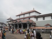
South Canara
District of British India in Madras, British RajSouth Canara was a district of the Madras Presidency of British India, located at 13.00°N 75.40°E. It comprised the towns of Kassergode and Udipi and adjacent villages, with the administration at Mangalore city. South Canara was one of the most heterogeneous areas of Madras Presidency, with Tulu, Malayalam, Kannada, Konkani, Marathi, Urdu, and Beary languages being spoken side by side. It was succeeded by the Tulu-speaking areas of Dakshina Kannada district, the Malayalam-speaking area of Kasaragod district and the Amindivi islands sub-division of the Laccadives, in the year 1956.
Read article
Top Questions
AI generatedMore questions


