Shatt al-Arab
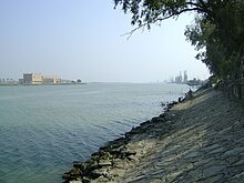
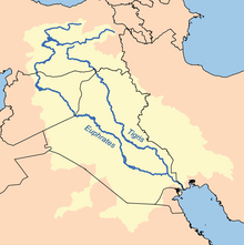
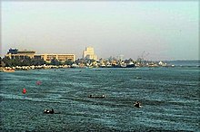
River in Western AsiaThe Shatt al-Arab is a river about 200 kilometres (120 mi) in length that is formed at the confluence of the Euphrates and Tigris rivers in the town of al-Qurnah in the Basra Governorate of southern Iraq. The southern end of the river constitutes the Iran–Iraq border down to its mouth, where it discharges into the Persian Gulf. The Shatt al-Arab varies in width from about 232 metres (761 ft) at Basra to 800 metres (2,600 ft) at its mouth. It is thought that the waterway formed relatively recently in geological time, with the Tigris and Euphrates originally emptying into the Persian Gulf via a channel further to the west. Kuwait's Bubiyan Island is part of the Shatt al-Arab delta.
Read article
Top Questions
AI generatedMore questions
Nearby Places

Khorramshahr
City in Khuzestan province, Iran

Karun
River in Iran

Battle of Khorramshahr (1982)
1982 battle of the Iran–Iraq War

Operation Karbala-4
Iranian offensive in the Iran–Iraq War

Battle of Khorramshahr (1980)
1980 battle in the Iran–Iraq War
Darband-e Gharbi
Village in Khuzestan, Iran
Sowreh, Khuzestan
Village in Khuzestan province, Iran
1974–75 Shatt al-Arab conflict
Armed border clash between Iran and Iraq


