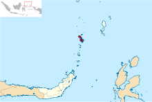
Sangihe Islands
Group of islands in IndonesiaThe Sangihe Islands – Indonesian: Kepulauan Sangihe – are a group of islands that constitute two regencies within the province of North Sulawesi, in northern Indonesia, the Sangihe Islands Regency and the Sitaro Islands Regency. They are located northeast of Sulawesi between the Celebes Sea and the Molucca Sea, roughly halfway between Sulawesi and Mindanao, in the Philippines; the Sangihes form the eastern limit of the Celebes Sea. The islands combine to total 813 square kilometers (314 sq mi), with many of the islands being actively volcanic with fertile soil and mountains.
Read article
Top Questions
AI generatedMore questions
Nearby Places

Sangihe Islands Regency
Regency of Indonesia


