San Bernardino Mountains
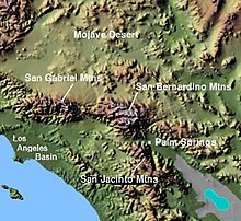
Mountain range of the Transverse Ranges in California, United StatesThe San Bernardino Mountains are a high and rugged mountain range in Southern California in the United States. Situated north and northeast of San Bernardino and spanning two California counties, the range tops out at 11,503 feet (3,506 m) at San Gorgonio Mountain – the tallest peak in Southern California. The San Bernardinos form a significant region of wilderness and are popular for hiking and skiing.
Read article
Top Questions
AI generatedMore questions
Nearby Places

Big Bear Lake
Reservoir in California, United States

Angelus Oaks, California
Unincorporated community in California, United States

Bear Creek (Santa Ana River tributary)
River in California, United States

Cedar Lake (California)
Reservoir in San Bernardino County, California

Snow Valley Mountain Resort
Skiing resort in California, United States
Rim Nordic Ski Area
Ski area
Little Green Valley (California)
Bluff Lake (San Bernardino County, California)
Lake in the state of California, United States


