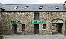
Saintfield
Human settlement in Northern IrelandSaintfield is a village and civil parish in County Down, Northern Ireland. It is about halfway between Belfast and Downpatrick on the A7 road. It had a population of 3,588 in the 2021 Census, made up mostly of commuters working in both south and central Belfast, which is about 18 km away. The population of the surrounding countryside is mostly involved in farming.
Read article
Top Questions
AI generatedMore questions
Nearby Places
Ouley Hill
Irish geological feature

Rowallane Garden
Historic garden in Northern Ireland

Ballynahinch Junction railway station
Railway station in County Down, Northern Ireland

Saintfield railway station
Former railway station in County Down, Northern Ireland

Ballygowan railway station
Shepherd's Bridge Halt railway station
Former halt in County Down, Northern Ireland

Ravara
Townland in Northern Ireland
Carrickmannon
Townland in Northern Ireland


