Río de la Plata (Puerto Rico)
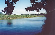
River of Puerto RicoThe La Plata River is the longest river in Puerto Rico. It is located in the north coast of the island. It flows from south to north, and drains into the Atlantic Ocean about 11 miles (18 km) west of San Juan. The mouth of the river is a resort area with white sandy beaches.
Read article
Top Questions
AI generatedMore questions
Nearby Places

Dorado, Puerto Rico
Town and municipality in Puerto Rico

Casa del Rey
Historic building in Dorado, Puerto Rico

Dorado barrio-pueblo
Historical and administrative center (seat) of Dorado, Puerto Rico

Jacinto Lopez Martinez Grammar School
Historic building in Dorado, Puerto Rico
1994 World Cup of Golf
Golf tournament

Residencia Don Andrés Hernández
Puerto Rico historic place
Residencia Doña Antonia Ramírez
Historic building in Dorado, Puerto Rico

De Luxe Florida
Historic factory building in Florida, Puerto Rico


