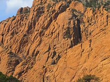
Royal Gorge
Canyon of the Arkansas River in Colorado, USThe Royal Gorge is a canyon of the Arkansas River located west of Cañon City, Colorado. The canyon begins at the mouth of Grape Creek, about 2 mi (3.2 km) west of central Cañon City, and continues in a west-northwesterly direction for approximately 6 mi (9.7 km) until ending near U.S. Route 50. Being one of the deepest canyons in Colorado, it is also known as the Grand Canyon of the Arkansas (River), with a maximum depth of 1,250 ft (380 m). The canyon is also very narrow, measuring from 50 ft (15 m) wide at its base to 300 ft (91 m) wide at its top, as it carves a path through the granite formations below Fremont Peak and YMCA Mountain, which rise above the north and south rims, respectively.
Read article
Top Questions
AI generatedMore questions
Nearby Places

Royal Gorge Bridge
Tourist attraction near Cañon City, Colorado

Buckskin Joe
Plainview Formation
Geologic formation in the United States

Colorado Territorial Correctional Facility
Medium security prison in Cañon City, Colorado

Parkdale, Colorado
Unincorporated community in Fremont County, Colorado, United States

Museum of Colorado Prisons
Prison museum in Cañon City, Colorado

Colorado Women's Prison
United States historic place

Grape Creek (Colorado)
Stream in south-central Colorado, US


