River Taw
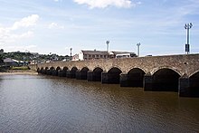
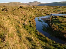
River in Devon, EnglandThe River Taw in England rises at Taw Head, a spring on the central northern flanks of Dartmoor, crosses North Devon and at the town of Barnstaple, formerly a significant port, empties into Bideford Bay in the Bristol Channel, having formed a large estuary of wide meanders which at its western end is the estuary of the River Torridge.
Read article
Top Questions
AI generatedMore questions
Nearby Places

Braunton Burrows
UK sand dune system

River Torridge
River in Devon, England

Saunton Sands
Beach in Devon, England

St Mary's Church, Appledore
Church

Appledore railway station (Devon)
Former railway station in Devon, England

Appledore Lifeboat Station
Lifeboat station in Devon, England

Lovers' Lane Halt railway station
Former railway station in Devon, England

River Caen
River in north Devon, England


