River Swere
Stream in Oxfordshire, EnglandThe River Swere is a stream in Oxfordshire, England, with a length of 2.09 kilometres and an elevation of 322 feet. The river's source lies around Swerford. It flows north towards Wigginton, and then turns east, passing just above South Newington, Barford St. Michael and Deddington before it feeds into the River Cherwell on the west side of the M40, opposite to Aynho.
Read article

Top Questions
AI generatedMore questions
Nearby Places

Aynhoe Park
Country house and estate in England
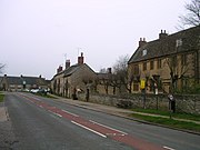
Aynho
Human settlement in England

Adderbury railway station
Former railway station in Oxfordshire, England

Aynho for Deddington railway station
Former railway station in Northamptonshire, England

Aynho Park railway station
Former railway station in Northamptonshire, England
Clifton, Oxfordshire
Human settlement in England

Sor Brook

St Michael's Church, Aynho
Church in Aynho, Northamptonshire