Rio Negro–Rio San Sun mangroves
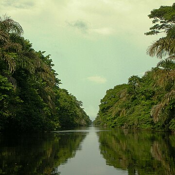
The Rio Negro-Rio San Sun mangroves ecoregion covers a series of small of discontinuous mangrove forests on the Caribbean Sea coast of Costa Rica, from a small portion inside the border with Nicaragua in the west to the border with Panama in the east. The coast on this stretch is a flat, alluvial plain, and mangroves are only a small part of a diverse patchwork of local habitats including swamps, mixed rainforests, coastal lagoons, sea grass beds, and sandy beaches. Much of the territory is "blackwater river" in character - slow-moving channels in wooded swamps with water stained by decayed matter. These mangroves are periodically damaged by hurricanes, such as in 1988 from Hurricane Joan, but are able to regenerate.
Read article
Top Questions
AI generatedMore questions
Nearby Places

Tortuguero, Costa Rica

Dr. Archie Carr Wildlife Refuge
Wildlife refuge in Costa Rica
Tortuguero Airport
Airport

Tortuguero River

Tortuguero National Park
National park in the Limón Province of Costa Rica
Tortuguero Protected Zone
Protected area in Costa Rica

Tortuguero Volcano
Inactive volcano of Costa Rica

