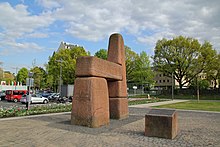
Rhineland-Palatinate
State in GermanyRhineland-Palatinate is a western state of Germany. It covers 19,846 km2 (7,663 sq mi) and has about 4.05 million residents. It is the ninth largest and sixth most populous of the sixteen states. Mainz is the capital and largest city. Other cities are Ludwigshafen am Rhein, Koblenz, Trier, Kaiserslautern, Worms, and Neuwied. It is bordered by North Rhine-Westphalia, Saarland, Baden-Württemberg and Hesse and by France, Luxembourg and Belgium.
Read article
Top Questions
AI generatedMore questions
Nearby Places

Dickenschied
Municipality in Rhineland-Palatinate, Germany

Gehlweiler
Municipality in Rhineland-Palatinate, Germany

Gemünden, Rhein-Hunsrück
Municipality in Rhineland-Palatinate, Germany

Hecken
Municipality in Rhineland-Palatinate, Germany

Womrath
Municipality in Rhineland-Palatinate, Germany

Ravengiersburg
Municipality in Rhineland-Palatinate, Germany

Maitzborn
Municipality in Rhineland-Palatinate, Germany

Rohrbach, Rhein-Hunsrück
Municipality in Rhineland-Palatinate, Germany


