Pájara
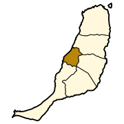
Municipality in Canary Islands, SpainPájara is a municipality in the southwestern portion of the island of Fuerteventura in the Province of Las Palmas in the Canary Islands as well as the name of its largest town. Its population is 20,931 (2013), and the area is 383.52 km2. Pájara is both the southernmost and the westernmost municipality on the island. Pájara is also the largest municipality on the island. The largest towns in the municipality of Pájara are Morro Jable and Costa Calma, both situated on the coast. The small port Ajuy is situated in the north of the municipality, near Betancuria. The Jandía peninsula is part of the municipality.
Read article


.jpg)
Top Questions
AI generatedMore questions