Purley, London
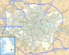
Human settlement in EnglandPurley is an area of the London Borough of Croydon in London, England, 11.7 miles (18.8 km) south of Charing Cross, with a history going back at least 800 years. It was originally granted as an estate from holdings at Sanderstead and until as a district of Surrey and then, with neighbouring Coulsdon, as an urban district that became an electoral ward of the London Borough of Croydon, becoming part of the ceremonial county of London, in 1965. In 2018 the Purley ward was divided into two: Purley and Woodcote, and Purley Oaks and Riddlesdown.
Read article
Top Questions
AI generatedMore questions
Nearby Places

Purley railway station
National Rail station in London, England

Reedham railway station (London)
National Rail station in London, England
Purley rail crash
1989 train crash in south London
Croydon Rural District
Former local government area in the UK

1928 Imperial Airways Vickers Vulcan crash
1928 test flight crash
Croydon Corporation Tramways
Thomas More Catholic School, Purley
Voluntary aided school in Purley, Greater London, England

Purley War Memorial Hospital
Community hospital in Purley, England


