Potrero Point
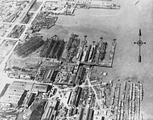
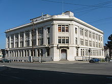
District in southeast San Francisco, CaliforniaPotrero Point is an area in San Francisco, California, east of San Francisco's Potrero Hill neighborhood. Potrero Point was an early San Francisco industrial area. The Point started as small natural land feature that extends into Mission Bay of San Francisco Bay. The Point was enlarged by blasted and cuts on the nearby cliffs. The cut material was removed and used to fill two square miles into the San Francisco bay, making hundreds of acres of flat land. The first factories opened at Potrero Point in the 1860s. Early factories were powder magazine plant, the Pacific Rolling Mill Company and small shipyards. The large Union Iron Works and its shipyards were built at the site, stated in 1849 by Peter Donahue. To power the factories and neighborhood coal and gas-powered electricity works were built, later the site became Pacific Gas and Electric Company (PG&E).


