Porter Brook
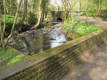
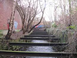
River in Sheffield, South Yorkshire, EnglandThe Porter Brook is a river which flows through the City of Sheffield, England, descending over 1,000 feet (300 m) from its source on Burbage Moor to the west of the city to its mouth where it joins the River Sheaf in a culvert beneath Sheffield railway station. Like the other rivers in Sheffield, its steep gradient made it ideal for powering water mills and works associated with the metalworking and cutlery industries, and around 20 dams were constructed over the centuries to facilitate this. At its lower end, it is extensively culverted, but parts of it are gradually being restored to open channels, as part of a daylighting scheme for the city.
Read article
Top Questions
AI generatedMore questions
Nearby Places

Ringinglow
Village in South Yorkshire, England

Fulwood (ward), South Yorkshire
Electoral ward in the City of Sheffield, South Yorkshire, England

Limb Brook
Stream in Sheffield, England

Whiteley Wood Hall

Forge Dam Park
Park in Sheffield, South Yorkshire, England

Fulwood Old Chapel

Fulwood Hall

Porter Valley Parks
Chain of public parks in Sheffield, England


