Porcupine Mountains
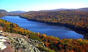
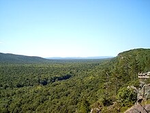
Park in Michigan, USThe Porcupine Mountains, or Porkies, are a group of small mountains spanning the northwestern Upper Peninsula of Michigan in Ontonagon and Gogebic counties, near the shore of Lake Superior. The Porcupine Mountains were named by the native Ojibwa people, supposedly because their silhouette had the shape of a crouching porcupine. They are home to the most extensive stand of old growth northern hardwood forest in North America west of the Adirondack Mountains, spanning at least 31,000 acres (13,000 ha). The area is popular among tourists, especially Lake of the Clouds in the heart of the mountains, and is part of Porcupine Mountains Wilderness State Park.
Read article
Top Questions
AI generatedMore questions
Nearby Places

Carp Lake Township, Ontonagon County, Michigan
Civil township in Michigan, United States

Nonesuch Mine

White Pine, Michigan
Census-designated place & unincorporated community in Michigan, United States
Little Iron River
River in the United States

Little Union River
River in the United States
Union River (Michigan)
River in the United States

Lake of the Clouds
Lake in Michigan, United States
Porcupine Mountains Ski Area
Ski area in Michigan, United States


