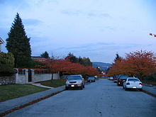
Parkcrest
Neighourhood in Burnaby, British ColumbiaParkcrest is a hillside neighbourhood in North Burnaby, British Columbia adjacent to Kensington Park which gave it its name. It has a long rectangular shape stretched north to south and is bounded by Springer Avenue to the west and Kensington Avenue to the east. To the north its border runs along Hastings Street, its southern border lies along the Lougheed Highway and Skytrain tracks. Its elevation gradually lowers to the south and ends up in Central Valley, quite low above the level of Burnaby Lake.
Read article
Top Questions
AI generatedMore questions
Nearby Places

Burnaby
City in British Columbia, Canada

Burnaby North
Provincial electoral district in British Columbia, Canada

Holdom station
Metro Vancouver SkyTrain station

Burnaby North Secondary School
School in Burnaby, British Columbia, Canada

North Burnaby
Neighourhood in Burnaby, British Columbia

Brentwood Park
Neighourhood in Burnaby, British Columbia

Kensington Park (Burnaby)
Park in Burnaby, British Columbia, Canada
Sullivan Heights, Burnaby
Neighourhood in Burnaby, British Columbia


