Map Graph

Ottawa National Forest

National forest in Michigan, United States

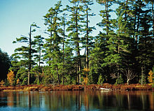
The Ottawa National Forest is a national forest that covers 993,010 acres (401,860 ha) in the Upper Peninsula of the U.S. state of Michigan. It includes much of Gogebic and Ontonagon counties, as well as slices of Iron, Houghton, Baraga, and Marquette counties. The forest is under the jurisdiction of the U.S. Forest Service.

Read article
File:Pinus_strobus_Syvania.jpgFile:MichiganNationalForests.svgFile:Photograph_of_a_Gasoline_Jammer_Loading_Logs_on_Car_-_NARA_-_2127627.jpgFile:O_Kun_de_Kun_Falls_Sign.jpgFile:Henry_Lake_Fall_Colors_-_Autumn_at_Ottawa_National_Forest,_Upper_Peninsula,_Michigan_(29936917032).jpg
Top Questions
AI generated

List the top facts about Ottawa National Forest

Summarize this article

What is the single most intriguing fact about Ottawa National Forest?

Are there any controversies surrounding Ottawa National Forest?

More questions