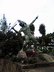
Oicatá
Municipality and town in Boyacá Department, ColombiaOicatá is a town and municipality in the Central Boyacá Province, Department of Boyacá, Colombia. The urban centre is situated on the Altiplano Cundiboyacense at an altitude of 2,815 metres (9,236 ft) and a distance of 153 kilometres (95 mi) from the national capital Bogotá and 15 kilometres (9.3 mi) from the department capital Tunja. It borders Cómbita and Tuta in the north, Chivatá and Tunja in the south, Chivatá in the east and in the west Cómbita and Tunja.
Read article
Top Questions
AI generatedMore questions
Nearby Places

Estadio La Independencia
Stadium in Tunja, Colombia

Chivatá
Municipality and town in Boyacá Department, Colombia

Motavita
Municipality and town in Boyacá Department, Colombia

Pedagogical and Technological University of Colombia
Public university in Colombia

Hunzahúa Well
Archeological site in Boyacá, Colombia

Goranchacha Temple
Tunja Airport
Airport

Central Cemetery of Tunja
Cemetery in Boyacá Department, Colombia


