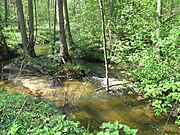
Oderbruch
The Oderbruch is a landscape located at the Oder river in eastern Germany on the Polish border, with a small part also in Poland. It extends from the towns Oderberg and Bad Freienwalde in the north to Lebus in the south, in the county of Märkisch-Oderland in the state of Brandenburg. The Oderbruch is about 60 km long and its width varies from 12 to 20 km for a total area of some 920 km2. It is a slightly inclined plane descending from 14 m in the southeast to just one meter above sea level in the northwest. The German name Oderbruch comes from Middle High German brouch meaning a marshy ground, swamp or moor, while the Polish name refers to Bad Freienwalde.
Read article
Top Questions
AI generatedMore questions
Nearby Places

Wriezen
Town in Brandenburg, Germany

Bliesdorf
Place in Brandenburg, Germany

Neulewin
Municipality in Brandenburg, Germany

Neutrebbin
Municipality in Brandenburg, Germany

Oderaue
Municipality in Brandenburg, Germany

Stöbber
River in Germany

Neutrebbin station
Railway station in Germany

Wriezen station
Railway station in Wriezen, Germany


