Ockley
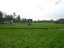
Human settlement in EnglandOckley is a rural village in Surrey. It lies astride the A29, the modern road using the alignment of Stane Street (Chichester). The A29 diverges from the A24 from London about 2.5 miles northeast and takes the alignment of Stane Street a mile north of the village. It has a medieval parish church, see list of places of worship in Mole Valley.
Read article
Top Questions
AI generatedMore questions
Nearby Places

Leith Hill
Hill in Surrey, England

Ockley railway station
Railway station in Surrey, England

Capel, Surrey
Village and civil parish in Surrey, England

Greensand Ridge
Range of hills in south east England, UK

Auclaye

Vann Lake and Ockley Woods

Broome Hall
Country house and estate in Surrey, England

Wallis Wood


