Map Graph

North Karnataka

Region in Karnataka, India

North Karnataka is a geographical region in Deccan plateau from 300 to 730 metres elevation that constitutes the region of the Karnataka state in India and the region consists of 13 districts. It is drained by the Krishna River and its tributaries the Bhima, Ghataprabha, Malaprabha, and Tungabhadra. North Karnataka lies within the Deccan thorn scrub forests ecoregion, which extends north into eastern Maharashtra.

Read article
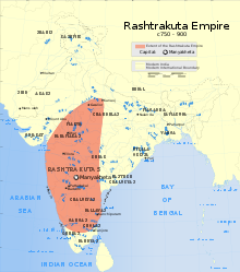
File:Distance_from_major_cities_to_North_Karnataka.jpgFile:Western_Chalukya_Monuments.svgFile:Badami-chalukya-empire-map.svgFile:Western-chalukya-empire-map.svgFile:Indian_Kadamba_Empire_map.svgFile:Indian_Rashtrakuta_Empire_map.svgFile:7th_century_Kannada_inscription_at_Mahakutesvara_temple_in_Mahakuta.jpgFile:Gadag_Trikuteshwara_temple_complex_3.JPGFile:Hampi-Old-And-New.jpg
Top Questions
AI generated

List the top facts about North Karnataka

Summarize this article

What is the single most intriguing fact about North Karnataka?

Are there any controversies surrounding North Karnataka?

More questions