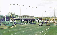
North Circular Road
Ring road around Central LondonThe North Circular Road is a 25.7-mile-long (41.4 km) ring road around Central London in England. It runs from Chiswick in the west to Woolwich in the east via suburban North London, connecting various suburbs and other trunk roads in the region. Together with its counterpart, the South Circular Road, it mostly forms a ring road around central London, except for crossing of the River Thames, which is done by the Woolwich Ferry.
Read article
Top Questions
AI generatedMore questions
Nearby Places
St Anne's Catholic High School
Voluntary aided school in Palmers Green, London, England

Millfield Arts Centre
Greentrees Hospital
Hospital in England
Oakthorpe Park
Human settlement in England

The Fox, Palmers Green

National Westminster Bank, Palmers Green

Truro House
North London Shamrocks
Gaelic football club in London


