Map Graph

Niya County

County in Xinjiang, China

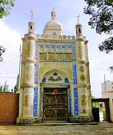
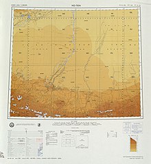
Niya County, also from Mandarin Chinese as Minfeng County, is a county within the Xinjiang Uyghur Autonomous Region and is under the administration of the Hotan Prefecture. It contains an area of 56,726 km2 (21,902 sq mi). According to the 2002 census, it has a population of 30,000. The county is bordered to the north by Xayar County, to the east by Qiemo/Qarqan County, to the west by Yutian / Keriya County and to the south by Ngari Prefecture in Tibet.

Read article
File:沙漠绿洲-民丰路口_-_panoramio.jpgFile:Location_of_Minfeng_within_Xinjiang_(China).pngFile:China_Xinjiang_Southern_location_map.svgFile:China_Xinjiang_adm_location_map.svgFile:China_edcp_location_map.svgFile:New_Mosque_-_Minfeng.jpgFile:Ruins_of_desert_Cathay_-_personal_narrative_of_explorations_in_Central_Asia_and_westernmost_China_(1912)_(14596524608).jpgFile:Txu-oclc-6654394-nj-44-3rd-ed.jpgFile:NJ-44-12_Takla_Makan_Desert.jpgFile:Txu-oclc-6654394-ni-45-4th-ed.jpgFile:NJ-44-16_Kola_China.jpgFile:Operational_Navigation_Chart_G-7,_6th_edition.jpgFile:Txu-pclmaps-oclc-22834566_g-7b.jpg
Top Questions
AI generated

List the top facts about Niya County

Summarize this article

What is the single most intriguing fact about Niya County?

Are there any controversies surrounding Niya County?

More questions