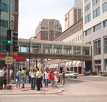
Minneapolis Skyway System
Pedestrian skyway system in downtown Minneapolis, Minnesota, United StatesThe Minneapolis Skyway System is an interlinked collection of enclosed pedestrian footbridges that connect various buildings in 80 full city blocks over 9.5 miles (15.3 km) of Downtown Minneapolis, enabling people to walk in climate-controlled comfort year-round. The skyways are owned by individual buildings in Minneapolis, and as such they do not have uniform opening and closing times. The 9.5 miles of skyway are comparable to the Houston tunnel system, the systems in Canadian cities such as Toronto's PATH, Montreal's Underground City, Calgary's 11-mile Plus 15 system and the 8-mile Edmonton Pedway system.
Read article
Top Questions
AI generatedMore questions
Nearby Places

IDS Center
Skyscraper in Minneapolis

Wells Fargo Center (Minneapolis)
Office in Minneapolis, Minnesota
KNOF
Radio station in St. Paul, Minnesota

Gaviidae Common
Shopping mall in Minnesota, United States
Minneapolis Thanksgiving Day fire
1982 fire

Walkin' Dog
Restaurant in Minneapolis

Northstar Center (Minneapolis, Minnesota)
United States historic place

Eggflip (restaurant)
Restaurant in Minneapolis


