Map Graph

Mechuka

Town in Arunachal Pradesh, India

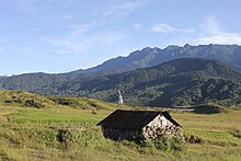
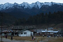
Mechukha or Menchukha is a town, assembly constituency and subdivision, situated 6,000 feet (1,829 m) above sea level in the Mechukha Valley of Yargep Chu/ Siyom River in Shi Yomi district of Arunachal Pradesh state of India. Before the 1950s, Mechuka valley was known as Pachakshiri.

Read article
File:Mechuka_overview_2.jpgFile:India_Arunachal_Pradesh_location_map.svgFile:India_location_map_3.pngFile:Mechuka_landscape_1.jpgFile:Menchukha_Pine_Forests.jpgFile:Menchukha_Town_at_the_Dusk.jpgFile:Menchukha_landscape,_river_Siyom_at_the_foreground.jpgFile:Menchukha_landscape,_river_Siyom_at_the_foreground_(2).jpg
Top Questions
AI generated

List the top facts about Mechuka

Summarize this article

What is the single most intriguing fact about Mechuka?

Are there any controversies surrounding Mechuka?

More questions