Maywood, Burnaby
Neighourhood in Burnaby, British ColumbiaMaywood is a mainly-rental low-income residential neighborhood in Burnaby, and is a part of the larger Metrotown area. The neighborhood consists of low-rise apartments built during the population boom in the Metrotown area in the 1970s, and 1980s, although the neighborhood is quickly changing with numerous highrises. Geographically, the Maywood neighbourhood's boundaries are Grange Street and Kingsway to the north, Nelson Avenue and Bennett and Bonsor Streets to the east, Imperial Street to the south and Boundary Road to the west, and it includes Central Park.
Read article
Top Questions
AI generatedMore questions
Nearby Places

Metrotown station
Metro Vancouver SkyTrain station
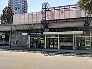
Patterson station (SkyTrain)
Metro Vancouver SkyTrain station

Metropolis at Metrotown
Shopping mall in Burnaby, Canada
CFML-FM
Campus radio station of the British Columbia Institute of Technology in Burnaby, British Columbia

Crystal Mall (British Columbia)
Shopping mall in Burnaby, British Columbia
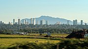
Metrotown, Burnaby
Town centre of Burnaby in British Columbia, Canada

Sovereign (building)
Skyscraper in Metrotown, Burnaby
Station Square collapse
Collapse of a Save-On-Foods supermarket in Burnaby, British Columbia, Canada