Mason–Dixon line
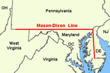
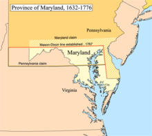
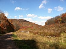
Surveyed border line between U.S. states of Delaware, Maryland, and PennsylvaniaThe Mason–Dixon line is a demarcation line separating four U.S. states: Pennsylvania, Maryland, Delaware and West Virginia. It was surveyed between 1763 and 1767 by Charles Mason and Jeremiah Dixon as part of the resolution of a border dispute involving Maryland, Pennsylvania, and Delaware in the colonial United States.
Read article
Top Questions
AI generatedMore questions
Nearby Places

Delaware Wedge
Border irregularity of Delaware
Strickersville, Pennsylvania
Unincorporated community in Pennsylvania, US

Wesley M.E. Church
Historic church in Delaware, United States

Mechanicsville, Delaware
Unincorporated community in Delaware, United States

Thompson Farm (London Britain Township, Pennsylvania)
United States historic place
Samuel Lindsey House
Historic house in Delaware, United States

Chambers House (Hopkins Bridge Road, Newark, Delaware)
Historic house in Delaware, United States

McClellandville, Delaware
Unincorporated community in Delaware, United States
