Magura National Park
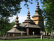
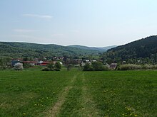
National park of PolandMagura National Park is a National Park located in the south-east of Poland, close to Slovakia, on the boundary of Lesser Poland Voivodeship and Subcarpathian Voivodeship. It covers the main part of the upper basin of the Wisłoka river. When the park was created in 1995 it covered 199.62 km2, although it is now only 194.39 km2 (75.05 sq mi), of which 185.31 km2 is forest.
Read article
Top Questions
AI generatedMore questions
Nearby Places
Gmina Krempna
Gmina in Subcarpathian Voivodeship, Poland
Huta Krempska
Village in Subcarpathian Voivodeship, Poland

Kotań
Village in Subcarpathian Voivodeship, Poland

Krempna
Village in Subcarpathian Voivodeship, Poland
Myscowa
Village in Subcarpathian Voivodeship, Poland

Polany, Podkarpackie Voivodeship
Village in Subcarpathian Voivodeship, Poland
Wrzosowa Polana
Settlement in Subcarpathian Voivodeship, Poland
Kąty, Podkarpackie Voivodeship
Village in Subcarpathian Voivodeship, Poland


