Lydd
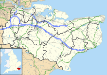
Town in Kent, EnglandLydd is a town and electoral ward in Kent, England, lying on Romney Marsh. It is one of the larger settlements on the marsh, and the most southerly town in Kent. Lydd reached the height of its prosperity during the 13th century, when it was a corporate member of the Cinque Ports, a "limb" of Romney. Actually located on Denge Marsh, Lydd was one of the first sandy islands to form as the bay evolved into what is now called Romney Marsh.
Read article
Top Questions
AI generatedMore questions
Nearby Places

Romney Marsh
Wetland in south-east England
Lydd Town F.C.
Association football club in England

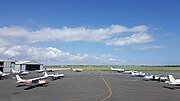
Lydd Airport
Airport in Kent, England

Lydd Town railway station
Former railway station in England

Lydd Ranges

All Saints Church, Lydd
Church in Kent, England

Denge Marsh
Marsh in Kent, England

Lydd Guildhall
Municipal building in Lydd, Kent, England


