Lusatia
Historical regionLusatia is a historical region in Central Europe, territorially split between Germany and modern-day Poland. Lusatia stretches from the Bóbr and Kwisa rivers in the east to the Pulsnitz and Black Elster rivers in the west, and is located within the German states of Saxony and Brandenburg as well as in the Polish voivodeships of Lower Silesia and Lubusz. Major rivers of Lusatia are the Spree and the Lusatian Neisse, which defines the border between Germany and Poland. The Lusatian Mountains of the Western Sudetes separate Lusatia from Bohemia in the south. Lusatia is traditionally divided into Upper Lusatia, the hilly southern part, and Lower Lusatia, the flat northern part.
Read article


.jpg)


Top Questions
AI generatedMore questions
Nearby Places

Bad Muskau
Town in Saxony, Germany

Łęknica
Place in Lubusz Voivodeship, Poland
Bronowice, Żary County
Village in Lubusz Voivodeship, Poland
Nowe Czaple, Lubusz Voivodeship
Village in Lubusz Voivodeship, Poland
Muskau Park
Riverside park on the German-Polish border
Räderschnitza
River in Germany
Legnitzka
River in Germany
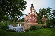
Schloss Muskau